Tuesday, October 20, 2009

El Niño to Help Steer U.S. Winter Weather

starSustainable Ecosystems and Community News - ENN
October 17, 2009 2:42 PM
by dotdotdotdotdotdotdotdotdotdotdotdotdotdotdotdot

El Niño to Help Steer U.S. Winter Weather

NOAA released a study this week projecting United States winter weather for the coming winter season. Using forecast E Niño conditions, the study predicts temperature and precipitation trends for the mainland US and Hawaii.


Art Trembanis
CSHEL
Univ of Delaware

Sunday, October 18, 2009

sorry!

Wow so sorry about that Art I didn't check my email this weekend! Here it is
pasted right into the email... hopefully next time I won't make such an airheaded
move! ... it looks like the pictures didn't come out?


Emily Cahoon
Cathedral Cove

Cathedral Cove is located in Whitianga at Coromandel Peninsula. It is only
accessible by foot or boat and is a famous marine reserve that includes
Gemstone and Stingray Bays, established in 1992. It is considered a must see
tourist attraction and gets about 150,000 visitors per year! There are many
outlying islands, providing a great area for swimming boating and fishing!
Traveling under the arch is forbidden due to falling rocks. The white cliffs here
are composed of ignimbrite about 8 million years old from a large and explosive
volcanic eruption! Additionally there are reefs of hard rock along with softer
sediment. Underwater caves and arches provide the perfect home for many of
New Zealand's critters including plants, crustacean, and fish.
The arch was used in the movie the Chronicles of Narnia as the passage by
which the children first enter into Narnia. The beach here is sandy with
pohutukawa trees which provide perfect amounts of shade. Also, just off this
beach there is a large rock consisting of pumice and breccia, which has been
eroded by both wind and water, many say it looks like a ship coming toward the
shore.

http://www.whitianga.co.nz/hahei.html
http://www.doc.govt.nz/parks-and-recreation/tracks-and-
walks/waikato/hauraki/cathedral-cove-walk/

Kaikoura

Kaikoura is located on the east coast of the south island of New Zealand.
The upwelling currents offshore of Kaikoura bring a plethora of marine life to
the area. The area is well know for its aquatic life, including whales, dolphins,
and seals. Additionally the crayfish is very popular and plays a decent role still
in the economy of the area. Also, Kaikoura is known for its excellent bird
watching areas including the albatross, a famous bird.
Geologically the Kaikoura Peninsula was formed underneath the sea about
60 million years ago and is composed of siltstone and limestone. It has only
been uncovered by the ocean for about 180,000 years, originally its own island;
however debris eroding off the Kaikoura Mountains created a bridge between
the two. The rapid uplift and relentless sea have transformed the once almost
flat layered limestone into strange and unusual shapes. Just offshore there is a
deep underwater canyon known as the Hikurangi Trench, which reaches down to
3000 meters and forms part of the Kermadec-Tonga Subduction Zone.
http://www.virtual-kaikoura.com/
http://www.tourism.net.nz/region/canterbury/canterbury---kaikoura/
http://www.doc.govt.nz/parks-and-recreation/tracks-and-walks/nelson-
marlborough/south-marlborough/kaikoura-peninsula-
walkway/features/geology/

Thursday, October 15, 2009

Secret to Slowing Global Warming Lies Beneath the Waves

starSustainable Ecosystems and Community News - ENN
October 14, 2009 3:46 PM
by dotdotdotdotdotdotdotdotdotdotdotdotdotdotdotdotdotdotdotdotdot

Secret to Slowing Global Warming Lies Beneath the Waves

Life in the ocean has the potential to help to prevent global warming, according to a report published today. Marine plant life sucks 2 billion tons of carbon dioxide from the atmosphere every year, but most of the plankton responsible never reaches the seabed to become a permanent carbon store. Mangrove forests, salt marshes and seagrass beds are a different matter. Although together they cover less than 1 percent of the world's seabed, they lock away well over half of all carbon to be buried in the ocean floor. They are estimated to store 1,650 million tons of carbon dioxide every year — nearly half of global transport emissions — making them one of the most intense carbon sinks on Earth. Their capacity to absorb the emissions is under threat, however: the habitats are being lost at a rate of up to 7 per cent a year, up to 15 times faster than the tropical rainforests. A third have already been lost.


Art Trembanis
CSHEL
Univ of Delaware

2 locations- Brianna Lyons

Christchurch, also known as the Garden City because of its parks and
botanical gardens, is located on the east coast of South Island and has a strong
English feel to it. It was originally established in 1850 by four ships of pilgrims
from England with the intention of making it a utopia with the perfect blend of
(Anglican) church and state, but the hardships of colonial life derailed the
idealistic beginnings of the city.
The city today has been called "more English than England," and does its
best to draw in tourists. Attractions include the Cathedral Square, home to a
Church of England cathedral, punting on the River Avon, and the Botanic
Gardens in Hagley Park.

http://www.christchurch.nz.com/cathedral-square.aspx
http://www.cityscape-christchurch.co.nz/wp-
content/uploads/2009/03/cathedral-chalic-christchur.jpg

http://www.new-zealand-travel-guide.co.uk/New-Zealand/Christchurch-
Botanic-Gardens-30.jpg


Tairua is located on the Coromandel Peninsula, just north of the Bay of
Plenty on the east coast of the North Island. The 584 foot tall volcanic Mount
Paku stands over Tairua, offering a view of nearby islands from its summit.
Tairua Harbor sits at the mouth of the Tairua River and is subject to shifting
sandbars impeding water traffic. This is an estuarine environment that can be
subdivided into "saltmarsh, mangrove, seagrass, and weed communities."
(http://www.ew.govt.nz/PageFiles/11059/TR0852.pdf) The area also appears
to be a vacation spot for New Zealanders.

http://www.new-zealand-travel-guide.co.uk/New-Zealand/Coromandel-
Tairua-Harbour.jpg


In my day-to-day internet travels I also came across these articles, unrelated to
my locations:
http://www.stuff.co.nz/the-press/news/2967140/NZs-favourite-bird-revealed
http://news.bbc.co.uk/2/hi/science/nature/8281382.stm

I personally found the BBC link extremely amusing :)

Erika Young (Wellington & Picton)

Erika Young

WELLINGTON, NEW ZEALAND
Sources: www.wellingtonnz.com
http://www.gns.cri.nz/wellingtonfault/

Wellington's Maori name is Te Upoko o te Ika a Maui, which means 'the head of Maui's fish'. The Maori say thatNew Zealand's North Island is a fish that was caught by Maui, the Polynesian navigator. Many Maori still inhabit Wellington today.
11.1% of New Zealand's population lives in the Wellinton region. Wellington is New Zealand's capital city and it is also where the seat of parliament is located. Wellington is also the home of Peter Jackson and Richard Taylor (LOTR) as well as Jemaine Clement and Bret McKenzie (Flight of the Conchords). The indie film, Eagle vs. Shark was filmed predominantly in Wellington.
The peninsula of Wellington lies on a massive fault line, called the Wellington fault. Wellington lies on top of the Australian plate, which sits over the subducted Pacific plate. The boundary between these plates lies about 25-
30km directly below Wellington. The plates move against each other at a rate of 3.5cm a year. The last major earthquake that occurred in Wellington was about 200 to 450 years ago and an earthquake is expected to occur every 500 to 1000 years. Wellington also lies above the Ohairiu Fault and the Wairarapa Fault, which last erupted in 1855.

PICTON, NEW ZEALAND
Sources: http://www.picton.co.nz/ http://www.newzealandnz.co.nz/picton/
http://www.newzealand.com/travel/getting-to-around-nz/getting-to-nz/cruise_home/picton/picton_home.cfm

The town of Picton is a busy port town located near the north east corner of the South Island, at the head of Queen Charlotte Sound. It is a major exporting hub in New Zealand Many go to Queen Charlotte sound to catch a ferry to Wellington, to go fishing, kayaking, and hiking.
One of the many historical sites in Picton includes Ship Cove, a place Captain Cook had visited numerous times while exploring New Zealand. He also visited Motuara Island, which is also where he claimed British sovereignty in 1770. The island is now a bird sanctuary and a place to watch seals, dolphins, and penguins.
ROTORUA

There are many interesting aspects of Rotorua that are unique to New Zealand and to Rotorua itself. Rotorua is an active volcano zone with many other intriguing qualities like the Maori culture; geothermal earth forces and 16 separate lakes! There are also tons of mud pools and exciting geysers locate in Rotorua. The thermal activity from the active volcano is what gives Rotorua its "famous sulfur smell." Kurai park is located within Rotorua and has mud pools, craters and "sulphur vents."
The actual volcano is Mt. Tarawera, which is not technically located in Rotorua but which is actually 25 miles southeast. Mt. Tarawera is actually a dormant volcano and visitors can fly to visit it from Rotorua. The beginning of the thermal activity began in Lake Rotorua, which used to actually be a violent active volcano. After the molten magma chamber that lay within the volcano collapsed, the chamber filled with water leaving a large lake. There are other thermal areas located in Rotorua as well including Whakarewarewa, Waimangu Valley, Wai-o-Tapu and Hell's Gate. A famed geyser, the Pohutu geyser, located in the Whakarewarewa thermal area, actually erupts multiple times during the day.
The Maori culture is also a very interesting aspect of Rotorua's history. These indigenous people actually contain over a third of Rotorua's population. Rotorua also contains a beautiful redwood forest. Christened "under the sails" people can go to visit this peaceful alcove and see some extremely old wildlife within the Redwoods.

PICTURES
http://www.cs.waikato.ac.nz/apchi2004/images/rotorua.jpg
http://cache.virtualtourist.com/696100-Rotorua_and_Mount_Tarawera-Rotorua.jpg
https://secure.touchnet.com/C20392_ustores/web/images/store_1/Rotorua_geiser.jpg
http://www.planetware.com/i/map/NZ/rotorua-map.jpg


ARTICLE ABOUT WAIKATO
http://www.waikato.ac.nz/news/index.shtml?article=360


TONGARIRO NATIONAL PARK
Tongariro national park, like Rotorua, is also a place rich with Maori culture and also volcanic history. This national park is located on the North Island near the towns of Turangi and Ohakune. This national park has 3 volcanoes named Tongariro, Ngauruhoe, and Ruapehu, which exist at the heart of the park. The volcanic activity is active and the volcanoes are 2 million years old. Ngauruhoe and Ruapehu are 2 of the most active volcanoes in the world including the eruptions in 1995 and 1996.
This national park is rich in contrasting land. There are "chaotic, barren lava flows, winter snowfields, hot springs and active craters" which all exist in the same place. There are many varying plants within the park including "alpine herbs to thick swathes of tussocks and flax, from the hardy, low-growing shrubs of the Rangipo gravel-field to dense beech forests," and these plants flourish although the park is a harsh environment for plants.
Many interesting animals also thrive in the park including the only mammals in New Zealand, the short and long tailed bats. There are also a large variety of birds including north Island robins, fantails, parakeets and even a kereru.Tongariro national park was the first national park in New Zealand, founded in 1887. It is a very beautiful and exotic place to visit with a lot of interesting different biological and cultural phenomenon including the volcanoes and the essence of the Maori culture.

PiCTURES:

http://www.planetware.com/i/photo/tongariro-national-park-turangi-nz740.jpg
http://www.photoseek.com/07NZ-3/bin/images/large/07NZ_7156_Mt_Ngauruhoe_2287m.jpg
http://img5.travelblog.org/Photos/24856/237792/t/1881822-Volcanic-goings-on-in-front-of-the-Emerald-Lakes-in-Tongariro-National-Park-1.jpg

VIDEO:
http://www.nzonscreen.com/title/tongariro-national-park-1951

Royce Jones: New Zealand Loacations

Locations in New Zealand

Wellington:
Wellington is one of the largest cities in New Zealand, and also the capital of the country located along the southern tip of the north island. The city is between Lambton Harbor to the east and a large mountain range to its west. In this mountain range lies an active fault line, which causes a number of earthquakes in the area. The city lies on land with various elevations and gets lower towards the bay. Various types of animals inhabit the area around Wellington, including wild goats that graze in the mountains and deer are often seen. Seal's are found along the coasts next to the mountains throughout the entire year. Along the coast there can be many different geological features found, having red rocks, many caves, and steep drops off high cliffs.
The population of the city is around 180,000, while the entire urban area of Wellington contains a population close to 450,000 people. It is a relatively diverse city, many Europeans, but many other races including the native inhabitants called the Maori. The climate is very temperate with little change in temperature throughout the year. The temperature averages in the summer range from 56-69 F, and during the winter from 52-7 F. The city is known for having a wide selection of very good restaurants and a good schooling system. There are many great views of the city and its surrounding landscape all over. Below are some pictures I found to be very interesting.
http://www.panoramio.com/photo/9842749
http://www.panoramio.com/photo/11362021
http://upload.wikimedia.org/wikipedia/commons/1/19/Wellington_panorama.jpg
http://www.panoramio.com/photo/13628674
http://www.wellingtonnz.com/about_wellington/wellington_facts/wellingtons_early_history


Cathedral Cove:
Cathedral Cove is an interesting place with a very serene landscape. This area has a very low population and contains a small residential area with houses and different attractions related to the cove it's self; Such as kayaking and snorkeling. The area is right along the coast of the northern part of the north island. Nearly 150,000 people a year come visit this beautiful terrain. It is a tough journey along the steep cliffs and rocky paths to see the best things. One of the most incredible geological areas is right on the beach where a cavern goes under a great amount rock and can walk under to both sides. From this "tunnel" you can see an interesting geological happening of large rock that sticks out of the water.
The colors of the rocks in the area are predominately an off white color with vegetation growing everywhere. The water is a very clear blue with many different fish species along the coast. Macadamias are grown in the area and are well known to be very good. Millions of years of weathering in pressure have shaped this landscape along this coast into the amazing sight it is to see. Below are some pictures that caught my eye and hopefully I come back with some of my own.
http://www.panoramio.com/photo/977295
http://www.panoramio.com/photo/18325095
http://www.panoramio.com/photo/851766
http://www.panoramio.com/photo/10495288

ninety mile beach & mount maunganui

samantha eulo


Ninety Mile Beach
Ninety Mile Beach is on the west coast of the Aupouri Peninsula in New Zealand
stretching from Ahipara to Scott Plain. The sand on Ninety Mile Beach is made
up of quartz with little silt and clay. Because of south-westerly swells during
storms, there is an overall deposition of sand instead of erosion which forms
dunes that sit off the coast. Along the beach there is also a low rocky area
called the Bluff. A past time of the people that live near Ninety Mile Beach is
off-roading. Because the beach is flat and the sand is packed people drive their
cars around for fun.
Species diversity is low compared to other areas of New Zealand but there
are many crustaceans and mollusks. Tautua, a shellfish, has been exploited
over the years and the harvesting of it is illegal. This shellfish along with
toheroa are found in the low inter-tidal zone. Ninety Mile Beach is popular
among birds and lizards and is also a winter grounds for fur seals.
This video shows the flat beach and the dunes.:
http://www.youtube.com/watch?v=-ZgZqiWrSYk
The Bluff: http://davidwallphoto.com/images/%7BB7190086-CFBA-460D-
A445-82E4B18780DE%7D.jpg

Picture: http://z.about.com/d/goaustralia/1/0/_/B/90mbeach.jpg


Mount Maunganui
Mount Maunganui is a town in The Bay Of plenty, New Zealand. It is also the
name of a large dome created by upwelling that was filled with rhyolite lava a
few million years ago, now known as Mauao, it's official Maori name. Mauao is
very important and sacred to the Maori people and is featured extensively in
their mythology.
The highest point on Mauao is 232 meters adove sea level. You can climb this
dormant volcano, though difficult it is very rewarding because the view is
fantastic. There are also geothermal springs at the bottom of the mountain that
creates a multitude of hot pools.
Picture: http://www.berm.co.nz/mount_maunganui_accommodation_2.jpg
Video: http://www.youtube.com/watch?v=rrWzNRYT6e0


Works Cited:
http://www.edesignz.co.nz/hosted/rakiora/A10_Ninety_Mile.htm
http://www.teara.govt.nz/en/geology-overview/11/2
http://en.wikipedia.org/wiki/Mount_Maunganui

Emily Cahoon New Zealand

I have attached the document as a word file!

Christchurch and White Island Blog

Rob Gardiner
Christchurch and White Island

My two places to research were Christchurch and White Island. Christchurch presented some difficulty when trying to find out more about its geology and biology because it is a small to medium-sized, highly developed, urban center. However, due its location on the South Island, Christchurch is an ideal launching pad for many excursions to discover the fascinating geology and coastal biology of New Zealand. Christchurch's website, http://www.christchurchnz.com/, offers links to an overwhelming amount tours, hikes, cycling excursions, and nature walks that all leave from the centrally located "Garden City" and take you into the heart of the South Island.
For example, from Christchurch you could take a coach bus to Tasman Valley, followed by a guided half hour tour through a moraine which brings you to Tasman Glacier Terminal Lake. At the lake, you board a small boat that brings you around to observe the awesome power of glaciers and how they are ever changing the landscape. http://www.infboats.com/wp-content/uploads/2009/05/tasman_glacier_-_inflatable_boat.jpg

White Island, as opposed to Christchurch, is in itself a terrific place to experience first hand the explosive creation of New Zealand. Located 48 kilometers off the Bay of Plenty in New Zealand's North Island, White Island is New Zealand's only active marine volcano and readily accessible to tourists. A trip to White Island offers amazing exposure to both the geology and the biology of New Zealand. On a boat trip out to the island, you will encounter diverse bird life as well as inquisitive dolphins alongside the boat. The website dedicated to White Island offers webcam screenshots of the volcano updated daily. http://www.wi.co.nz/ The volocano is dated to be somewhere between 100,000 to 200,000 years old but in some areas it is only 16,000 years young.
A walking tour of White Island is said to be an exhilarating experience for all of your senses. At first, you will notice a barren moonscape, void of vegetation. The only color is the bright yellow sulfur deposits. Then you will hear the hissing of steam all around you, evidence that the volcano is by no means dormant. You will also be able to detect the strong odor of sulfur as it emits through the vents below your feet. http://www.whiteisland.co.nz/white_island.html

Cities Blog

Tairua

Tairua is located on the North island of New Zealand, along the eastern coast.
http://www.pakulodge.co.nz/Cache/Pictures/599096/6_map2.jpg

Tairua is located on a part of the north island known as the Coromandel peninsula. Geologically speaking, this area is composed of Miocene and younger volcanics, including andesites and rhyolites. The beach at Tairua contains examples of rhyolite on the rocks and the beach pebbles. The Coromandel peninsula has been popular as a collector's site because it is home to gold and silver ores and crystals. They can still be found at old mine dumps, but it is rare.

Tairua is known as a tourist spot because of its coastal location. People flock here for the beaches, surfing, fishing, kayaking, and scuba diving. Many of these activities can be done through a popular business called Tairua Dive and Fishinn.
http://www.divetairua.co.nz/uploads/60155/images/tfd_footer_images.jpg

Tairua also has some other small attractions such as the Manaia Gallery, which features unique art and gifts, and the Manaia Café and bar located next door. Art is popular in the area, but Tairua is mostly known for the outdoor and water sports.


Rotorua

Location- Rotorua is also located on the North Island of New Zealand, but south and inland of Tairua.
http://www.accommodationrotorua.info/images/rotorua-map2.gif

Rotorua is a famous tourist attraction because of the geothermal activity. It is sometimes referred to as the "Sulfur City" because of the smell produced. There are many interesting sites including mud pools, geysers, and hot springs. Rotorua has earned the name "Cureland" due to the health benefits of these hot springs. Popular hot springs include the Hells Gate Thermal Reserve, Waikite Valley Thermal Pools, and the Polynesian Spa.
The Rotorua Lakes are a very important part of the area. Unfortunately, most of them are threatened due to an increase in nutrient input in the lakes. This causes many of the lakes, like Okaro and Rotorua, to be subject to large algal blooms. These algal blooms can be a health hazard and show that the lakes are in a poor ecological condition.
http://www.fishingtrout.co.nz/content/images/misc/map.gif
http://sci.waikato.ac.nz/farm/images/DH%20algal%20bloom%20in%20rotorua.jpg

There are also a few museums located in Rotorua. One museum that looked interesting is the Caterpillar Experience. This museum dedicated to the Caterpillar machines and tractors that helped shaped the landscape and development of New Zealand. For more Rotorua-specific history, the Rotorua Museum is also located in the city.


-Laura Treible

Taupo and Waitangi Treaty Grounds

Taupo and Waitangi Treaty Grounds - Jessi Wenke


Waitangi Treaty Grounds

Located on the North Island overlooking the Bay of Islands is the Waitangi National Trust and Treaty Grounds, where on February 6, 1840 the several Maori chiefs and British Representatives met and signed the Treaty of Waitangi (Te Tiriti o Waitangi), which established British sovereignty over New Zealand. A British governor was appointed and given rule over the land and the rights and privileges of British citizens were extended to the Maori peoples.
The introduction of muskets to the Maori in the early part of the 19th century resulted in warring among the tribes. Not all of the different tribes had acquired firearms and the results were devastating. An estimated 20,000 Maori lost their lives in what would become known as the Musket Wars. Concerned over the warring between various groups of Maori and newcomers, particularly French, to the land, members of several northern tribes sent a letter to King William IV asking for protection of their lands. In 1835, James Busby, a British representative, and 35 chiefs of northern tribes signed the Declaration of Independence of New Zealand. The first of several documents that eventually led to the signing of the Treaty of Waitangi in February of 1840.
Realizing the historic significance of the site as the "Birthplace of New Zealand", in 1932, Lord Bledisloe, Governor-General of New Zealand and his wife, Lady Bledisloe, purchased the estate, that includes the house and site where the Treaty was signed, and gifted the property in trust to the people of the country.
In addition to the to the treaty house and gardens, the estate is home to other "taonga" (treasures) such as the Te Whare Runanga; a carved Maori meeting house dedicated on the centennial celebration of the treaty's signing and Ngatokimatawhaorua; one of the world's largest Maori carved ceremonial war canoes, not to mention the natural beauty of the estate grounds and breathtaking views of the Bay of Islands.
http://www.waitangi.net.nz/index.htm
http://www.nzhistory.net.nz/category/tid/133


Taupō

Centrally located on the North Island and sitting at the northeastern outlet of New Zealand's largest lake, Lake Taupō where it discharges into the Waikato River is the town of Taupō.
Maori Polynesians are recognized to have settled the Taupō area as early as 700 years ago. In the early 1700's the Tuwharetoa tribe displaced earlier tribes of which little is known. Taupo is now the North Islands most recently developed urban centre.
Taupō is located in the geologic region known as the Volcanic Plateau. Dominated by three calderas; Taupō, Rotorua, and Okataina, the Taupō Volcanic Zone is the eruptive region of the plateau. Lake Taupō, the flooded caldera, is the largest in the region and was created by a massive eruption approximately 26,000 years ago. The eruption was the most recent to reach VEI-8, the highest level on the Volcanic Exposivity Index. The Taupō Volcanic Zone extends from Whakatane Volcano at its northeastern border to Ruapehu Volcano at its southwest; an area roughly 350 km by 50 km and marks the southwestern border of the Pacific Ring of Fire.
Visitors to the area can enjoy various natural attractions such as Huka Falls, Taupō's most visited site, situated north of the town on the Waikato River. The Craters of the Moon is a popular geothermal area, and in the Wairakei Tourist Park is the Volcanic Activity Center that offers interactive exhibits and information of the Taupō Volcanic Zone. Others not to miss attraction include Aratiatia Dam, the picturesque lakeside village of Kinloch, the 5 mile lakeside Lions Walk, Mount Tauhara and Waipahihi Botanical Reserve.
There is no shortage of activity in Taupō. Adventure enthusiasts can find Taupō Bungy located in the Hells Gate section of the town center. Three skydiving companies operate out of the Taupō Airport; Skydive Taupō, Taupō Tandem and Freefall Skydive, catering to all levels, from beginner to advanced. Scenic flights can be booked by plane or helicopter at numerous locations. There are also several locations that offer jetboating, sailing and cruises.
Another popular lure to Taupō is the fishing. Trout were first introduced to Lake Taupō in 1887, and by 1895 the integration was so successful that Lake Taupō and its rivers became famous as an anglers paradise. Outfitters in the area offer gear to purchase or rent, or you can opt to sign on to a chartered expedition.
Riverside Market is the local marketplace and offers a wide variety of goods such as clothing, baked goods, jewelry, arts and crafts, books and collectables. Cafes and restaurants include BodyFuel Café , Replete and Plateau, just to name a few. The town center is generally compact and easy to get around in. Two easy ways; the Lake Taupo Hot Bus and Shuttle 2U. Rental cars are available at several locations as well as ample taxi services.

http://www.otago.ac.nz/geology/people/white/Taupo-lake.html
http://www.teara.govt.nz/en/volcanic-plateau-places/11/
http://www.laketauponz.com/

Wednesday, October 14, 2009

Blog for Picton and Waipoua Kauri Forest

Brett Friedberg

Picton is a town in the north east corner of the south island of New Zealand with a population of less than 3,000 people. Picton is the main town where ferries travel between the two islands through the Queen Charlotte Sound. Picton is a major tourist destination with many waterfront cafes and dolphin/seal watching. There are many places to hike and see the different views of the sound. Between the Waikawa Bay and Picton there is a snout where you can see a great view of the peninsula.

http://www.travelpod.com/travel-blog-entries/charmedlife/rtw-2006/1175937840/tpod.html - a blog about traveling into Picton

http://images.google.com/imgres?imgurl=http://upload.wikimedia.org/wikipedia/commons/b/bf/Picton_New_Zealand.JPG&imgrefurl=http://commons.wikimedia.org/wiki/File:Picton_New_Zealand.JPG&usg=__U89chddJxZ64mFoeutBXNVv-OeI=&h=1200&w=1600&sz=815&hl=en&start=1&um=1&tbnid=25ebA-GCFFi0TM:&tbnh=113&tbnw=150&prev=/images%3Fq%3Dpicton%2Bnew%2Bzealand%26hl%3Den%26sa%3DX%26um%3D1 – Picture of Picton
http://www.retireearlylifestyle.com/p1a.jpg - People having a great time in Picton

http://www.offexploring.com/photos/scottfree/photos/Queen%20Charlotte%20Sound%20104.jpg - Picton

Waipoua Kauri Forest is part of the largest remaining native forest in the northland. They are under the protection of the Department of Conservation, so none of it is being lost to make way for farmland or for timber. Kauri are the major trees that make up this forest. They are huge trees which make them a beautiful site to see. They can reach heights of 50 meters tall and reach widths of 16 meters. Beneath the canopy of the Kauri there is a good amount of diversity in the shrubs and smaller plants. This forest is home to one of New Zealand's endangered species, the Keruru which is a type of pigeon. Rats and possums have preyed on this pigeon which has been one of the reasons its population has decreased so much.
The Waipoua Kauri Forest has long been inhabited by the Maori people. This group of people rely on fishing and agriculture to live. Much of the forest was cut down when European settlers came to New Zealand. This was due to the size of the Kauri trunks and the need/want for farmland in this area. Eventually in 1952, the 9,105 hectare Waipoua Sanctuary was created to help preserve the forest until the Department of Conservation was able to increase protection of the forest.

http://aviary.owls.com/wood_pigeon/wood_pigeon.html - A little bit about the New Zealand pigeon!

http://www.davidwallphoto.com/images/%7B6D5EA0B1-0890-48C8-AF97-E136AC011AA9%7D.jpg – picture of a Kauri tree
http://nzphoto.tripod.com/forest/images/kauri01.jpg - Picture of Waipoua Kauri Forest

http://www.travelpod.com/travel-blog-entries/liammichelle/downunder-0405/1103258160/tpod.html - blog from someone who visited the Waipoua Kauri Forest
Wellington is the capital of New Zealand, located on the southern tip of the north island. From Maori tradition, it was first named "Te Upoko o te Ika a Maui," meaning "the head of Maui's (a Polynesian navigator) fish (the northern island)." Te Whanganui aTara (the great harbour of Tara) is another Maori name for the area, after the founder of the first iwi (tribe) in Wellington, the Ngai Tara. In the present day, Maori with tribal affiliations stretching from the far North to the deep South live and work in Wellington, contributing to the cultural diversity of the city. The population of the city of Wellington (179,463) accounts for 4.5% of the total New Zealand population, and the surrounding areas of Wellington (448,956) contribute in total 11.1% of the New Zealand population. Wellington is the city most connected to the internet in the most "fully wired" country in the world.
Wellington is home to most national theatre, dance and perfomance companies, as well as the national museum, Te Papa, national archives, and national library. It is the center of the government and thus has buildings such as the Beehive, where governmental officials have their offices, and the Parliament Building. There is a National War Memorial commemorating all the New Zealanders who gave their lives or served in any war, along with the Tomb of the Unknown Warrior, which contains the remains of an unidentified New Zealand soldier who died on the Western Front during World War I. Westpac Stadium is the main sporting venue in the city. It is the home of the football team the Wellington Phoenix, and also holds events such as concerts and cricket matches. The headquarters of WETA Workshop are also located in Wellington.
Wellington is surrounded by waterways including Lyall Bay, Evans Bay, Island Bay, Shelly's Bay, Port Nicolson, Lambton Harbour, and Oriental Bay, which has a spectacular man-made fountain in the center of the bay. Taputeranga Island is one of several islands located in the area, and has traditional significance in folklore. It is also surrounded by a marine sanctuary. The inter-island ferry leaves from Wellington and then heads to the south island. There are several surfing spots, beaches, and popular dive sites, including Barrett reef, formed in 1968 from the sinking of the Wahine Ferry, and less than a kilometer off the coast, the F69 dive site where the former Leander-class Navy frigate HMNZS Wellington was sunk to form an artificial reef.
Mount Victoria is smack in the middle of Wellington. Visitors can hike or drive to the top to get a panoramic view of the city and the surrounding area. There is also a path on the mountain where one of the scenes from The Lord of the Rings was filmed. Underneath the mountain there is a tunnel to go from one side of the city to the other. To the northwest of Mount Victoria, visitors can stop by the Carter Observatory by way of the scenic route of the Wellington Cable Car. A short walk from the Cable Car terminal can bring you to such interesting places as the Wellington Botanical Gardens, Kelburn Park, and Victoria University. Several universities are within the city limits.
To me, the city style is very reminiscent of a larger Mexican or Italian town, from the architecture to the city layout. While it seems relatively small by our standards, it has a lot to offer and to be discovered!

Links:
City of Wellington official site - http://www.wellingtonnz.com/
National War memorial - http://www.nationalwarmemorial.govt.nz/
Wellington Phoenix - http://www.wellingtonphoenix.com/
Te Papa National Muesum - http://www.tepapa.govt.nz/pages/default.aspx
Wellington Cable Car - http://www.wellingtonnz.com/sights_activities/wellington_cable_car
Diving - http://www.wannadive.net/spot/Australia_Pacific/New_Zealand/NI/Wellington/


Cape Reinga, part of the "Northland," is one the northernmost point of New Zealand. It is here that the Tasman Sea meets the Pacific Ocean, which is visibly manifested in churning seas and high waves off the point. There is no population, but it is a popular tourist spot and a lighthouse 961 feet above sea level with a beam that can be seen 49km out to sea, built in 1941, is located on the point, and it is part of the Te Paki Recreation Reserve. At the northernmost tip of the cape is a gnarled pohutukawa tree, believed to be over 800 years old and to have never blossemed. According to Maori legend, the spirits of Maori deceased leap from this tree into the ocean to return to their ancestral homeland of Hawaiiki. There are several Maori archeological sites in the area.
There are green pastures in the area surrounding the cape, and the well-named 90-mile Beach is one way to get near to Cape Reinga. Giant sand dunes at the Te Paki stream are commonly boogie-boarded down to gorgeous beaches. A hike away is Spirits Bay, where horses graze in lush pastures and a variety of wildlife can be found. Each year at Spirits Bay in March godwits from all parts of the country assemble here for a 12,000km flight north to their breeding grounds in the Arctic tundra of Siberia and Alaska.

Links:
General information - http://www.newzealand.com/travel/destinations/regions/northland/towns.cfm/nodeid/25.html
Some info with great photos - http://www.travel.hickerphoto.com/cape-reinga-new-zealand-info.htm
Wildlife info - http://www.ecotours.co.nz/wildlife/index.htm
Area info - http://www.doc.govt.nz/parks-and-recreation/places-to-visit/northland/kaitaia-area/cape-reinga-and-te-paki/features/sites-of-interest/

Whitianga and the Waitangi Treaty Grounds

Amanda DePasquale
New Zealand Study Abroad W10

1. Whitianga, New Zealand
Whitianga is located in the northern half of the North Island of New Zealand. It is found on the Coromandel Peninsula and is the main town in Mercury Bay. Whitianga is a deep water harbor, great for fishing and scenic cruising. The activities in Whitianga include fishing and catching shellfish, along with water sports. There are also dolphins that swim around in the wharf, and you may get a glimpse of them, if you're lucky. On land, there are many great restaurants, as well as bush walks and horse trails to take part in. From Google Earth, you can see the town of Whitianga which is well-developed, along with the beautiful coastal beaches.
Whitianga was first settled by Kupe, a Maori explorer, and his tribe in 950 A.D. and has been continuously inhabited since then. From the 1800s to the early 1900s, Whitianga was a leading timber port. It is estimated that over sixty years, 500 million feet of kauri was exported. Whitianga was also known for its gum. Gum digging exports began in 1844, and by 1899 over 11,000 tons of kauri gum was exported. The industries that have thrived in Whitianga have included boat building, kauri milling, flax milling, gold mining and gum digging. Today, Whitianga prospers off of tourism, fishing, and farming for its wealth.
The beaches in Mercury Bay and in Whitianga provide a beautiful and scenic area to visit. We will be here from January 8-10. While here, we will get to visit Cathedral Cove, a marine reserve, where we can view naturally formed rock archways. Also, we will visit the Hot Water Beach, where, during low tide, we can dig our own hot pool out of the sand. These hot pools form from the underground superheated water that is stored in basins from previous volcanoes. The water can be as hot as 147°F! Another thing we can do is visit Kauaeranga Valley to see rivers, waterfalls, and forests. There is a snorkeling trail at Gemstone Bay, or we can sail across the bay to Cook's Coast, named after the famous explorer Captain James Cook.
The geology at Whitianga consists of volcanic rocks. In Whitianga, there are especially rhyolite and andesite. Some of these rhyolites are 6 million years old, with the youngest ones are 3 million years old. They are flow-banded by layers forming in the flowing lava, and some have spheres of clusters of quartz or feldspars. These spheres formed when the cooling lava crystallized. Some of the rhyolite also contains opal or zeolite mordenite. There is also ignibrite, which are giant white rocks that were formed from volcanic eruptions. They consist of angular pumice and volcanic ash made of rhyolite, formed over 8 million years ago.
As for biology, Mercury Bay, just off the shore of Whitianga, is packed with fish. There are many types of tuna and sharks, along with giant sea bass, marlins, snapper, swordfish, dolphin, tope, spearfish, wreckfish, wahoo, yellowtail kingfish, trevally, kahawai, hapuka, and albacore. There is also a game fishing club for fishing enthusiasts.

Links:
http://www.whitianga.co.nz/
http://www.newzealand.com/travel/destinations/regions/coromandel/coromandel-towns.cfm/nodeid/298.html
http://books.google.com/books?id=t-cOAAAAQAAJ&pg=PA151&lpg=PA151&dq=whitianga+geology&source=bl&ots=-iYehX0022&sig=ML_in1z24NKlXKNH10-25hglleM&hl=en&ei=QHXWSprhK4q6lAfir8SxBg&sa=X&oi=book_result&ct=result&resnum=7&ved=0CB0Q6AEwBg#v=onepage&q=&f=false
http://www.mbgfc.co.nz/index.cfm/pageid/1/ViewPage/Home

Photos:
http://www.teara.govt.nz/en/geology-overview/7/5/1
http://www.panoramio.com/photo/1370932
http://www.panoramio.com/photo/6395838
http://www.panoramio.com/photo/6395828
http://www.panoramio.com/photo/6395800
http://images.travelpod.com/users/karsenault/2.1222506120.hot-water-beach-boys.jpg

2. Waitangi Treaty Grounds
The Waitangi Treaty Grounds are located in the northern tip of the North Island. Here, over 500 Maori, settlers, traders, and missionaries came to witness the signing of the Treaty of Waitangi between the Maori and the British Crown on February 6th, 1840. The Treaty was written in both English and Maori, so there are some discrepancies as to what exactly was agreed. Basically, the treaty established a British governor in New Zealand, gave Maori ownership of their lands and properties, and gave Maori people the rights of British subjects. This treaty established New Zealand as a nation.
The treaty grounds are a very historical site for the people of New Zealand, and we will be visiting them on January 6th. Here, visitors can take different tours of the grounds and immerse themselves in the history of the country. There are also demonstrations and shows for entertainment. This area is rich with history and has multiple displays of artifacts from past tribes. The Treaty House, which is now a museum, was home to James Busby, a British "watchdog". He inhabited it from 1832 to 1844, and it was one of the first architectural British buildings. There is also the Whare Runanga, which is a Maori meeting house. It was built in 1940 to celebrate the 100th year since the signing. On Waitangi Day, February 6th, the world's largest canoe would be carried out by 80 warriors and paddled around the bay. This tradition stopped in 2005, but the canoe is on display for visitors to see. It is 35m long, which is about 115 ft, and called Ngatokimatawhaorua.

Links:
http://www.waitangi.net.nz/
http://www.nzhistory.net.nz/politics/treaty/the-treaty-in-brief
http://en.wikipedia.org/wiki/Treaty_of_Waitangi

Photos:
http://www.eske-style.co.nz/images/Maori%20Te%20Whare%20Rununga%20Waitangi%20Far%20North_B.jpg
http://farm1.static.flickr.com/147/348783694_fddb7bf3a4.jpg
http://www.panoramio.com/photo/6577064
http://www.panoramio.com/photo/416893
http://www.eske-style.co.nz/images/Maori%20Te%20Whare%20Rununga%20Waitangi%20Far%20North_B.jpg

New Zealand Study Abroad Sites

Hot Water Beach:
Hot water beach is located on the east side of the Coromandel Peninsula on the north island of New Zealand. Visitors flock to the beach for the opportunity to dig their own spas. All one needs to do is dig a hole in the sand within 2 hours of low tide, and wait for the hole to fill up with hot water. This is possible because of the geologic activity nearby the beach. Volcanic activity superheats underground water reserves which then seep, through two main fissures, to the surface through the sandy beach. This unique environment makes the beach a popular tourist attraction and an interesting study site for scientists, as well.

There are many other things to do at the beach as well. Visitors can swim, snorkel, dive, and surf there, although, the rip tides in the area can be very dangerous. There is also a nearby campground and surf shop.

http://www.panoramio.com/photo/25469075

JürgenDigitalNikon. "Hot Water Beach." 10 August 2009. Online Image. Panoramio. 12 October 2009. < http://www.panoramio.com/photo/25469075>.


Picton:
Picton has a population of about 3000 people is located on the north-eastern side of the south island, near the head of the Queen Charlotte Sound. This sets Picton up as a major ferry route between the two islands. Many visitors to New Zealand end up traveling through this city.

The city was named after Sir Thomas Picton, who was the most senior Seventh Coalition officer killed in the Battle of Waterloo in 1815 (he was a Lieutenant General for the British Army). Ironically, he died wearing civilian clothes and a top hat, because his luggage had not arrived on time.

Also from the 19th century, the city is home to the oldest merchant sailing ship that is still floating, the Edwin Fox. In her earlier years, the Edwin Fox brought prisoners to Australia, brought settlers to New Zealand and Australia, and served in the Crimean War. She is now docked at the Edwin Fox Maritime Centre, adjacent to an informative museum.

http://www.panoramio.com/photo/89041

http://www.newzeal.com/steve/Ships/EdwinFox.htm

Tillius. "Picton." 29 November 2006. Online Image. Panoramio. 12 October 2009.
<http://www.panoramio.com/photo/89041>.

havelock and paihia

New Zealand Locations
Waipoua Forest
Waipoua Forest is located on the tip of North Island. The forest is home to Tane Mahuta, New Zealand's largest known living kauri tree. Waipoua forest was bought from the Maori in 1876 for around 2000 pounds. It was declared a sanctuary in 1952, the sanctuary covers around 80 km2 and it contains 3/4 of New Zealand's kauri trees. In 2007 the forest was threatened by a wildfire that started by someone cooking mussels over on open fire. The fire came within 3km of Tane Mahuta and destroyed oven 2km2 of vegetation. It killed and estimated 20 North island brown kiwis.
The Waipoua forest is home to the largest population of North island brown kiwi. The north island brown kiwi is the most common of all the kiwis. The north island kokako is also found in the Waipoua forest. The north island kokako has blue wattles, while the south island kokako has orange wattles. The north island kokako is endangered, and the south island kokako was formally declared extinct on 16 January 2007.

Links
http://www.doc.govt.nz/parks-and-recreation/places-to-visit/northland/kauri-coast/waipoua-forest/
http://www.absoluteastronomy.com/topics/Waipoua_Forest

Some photos
http://www.hickerphoto.com/data/media/152/waipoua-forest_9420.jpg
http://cache.virtualtourist.com/926560-BIg_Kauri_Tree_Waipoua-Waipoua_Forest.jpg

Hamilton
We will be staying in Hamilton from January 10 to the 27th at the University of Waikato. Hamilton is on North Island and it is New Zealand's largest inland city. The Maori from the Tainui waka inhabited Hamilton for 700-800 years until 1863 when the land was confiscated by the crown.
While in Hamilton, there are plenty of things to do. Kayaks and canoes can be rented,or you can go rock climbing, zorbing and hiking. We will be visiting white island (January 16) and Waitomo glowworm caves (Jan 18). Hamilton also has Waikato Museum and Putaruru Timber Museum. The Waitakaruru Sculpture Park and Arboretum has 60 to 90 sculptures along a 2km trail. SOUL Gallery has a variety of jewelry, wall art, and ceramics. The Robinson Sports Museum is a good place to go if you are interested in sports history and old sporting equipment. If you want to hike, Taitua Arboretum has an excellent collection of mature trees. Other hiking spots include Waikato River Trail Lake Ngaroto Marokopa Falls, the Te Waihou Walkway and the Bridal Veil Falls. Ruakuri Scenic Reserve has beautiful limestone outcrops (it is about one hour from Hamilton).

Links
http://www.visithamilton.co.nz/
http://www.waikato.ac.nz/home.shtml (University of Waikato website)
http://www.doc.govt.nz/parks-and-recreation/tracks-and-walks/waikato/maniapoto/ruakuri-walk/ (Ruakuri Scenic Reserve site)
Some photos
http://www.visithamilton.co.nz/photogallery.aspx?category=297&image=3153
http://www.visithamilton.co.nz/photogallery.aspx?category=297&image=3146

Katy Ames

Kristen Beebe- sorry

Dear Dr. Art Trembanis,
Sorry for being so casual in my previous emai concerning who I wrote to. Also,
if the attachment is not what you prefer, I copied the text:Kristen Beebe
Winter Study Abroad 2010- New Zealand
Paihia
Paihia is known as the jewel of the Bay of Islands, located in the far north of the
north island of New Zealand. This tropical town is one of the most popular
tourist destinations due to several reasons. Cultural centers, beaches, scenic
beauty, and fun food and drink make the spot ideal for the vacationer. From the
dolphin sight seeing tours to the Wharepuke subtropical gardens, there is
always something to entertain oneself in Paihia.
To begin, there are several recreational activities for one to experience
while vacationing in this location. Salt water fishing is a popular sport due to the
abundant species of salt water fish in the bay. The Earl Grey Fishing Charters are
based here and are one of the most popular companies to operate out of Paihia.
Beautiful beaches abound in Paihia excellent for simply relaxing or observing
the wonder of New Zealand. Adding to the whimsy quality of the bay is the
constant steamboat cruises.
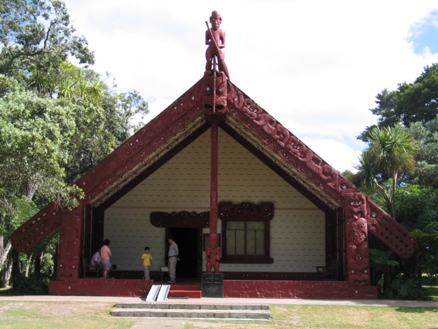
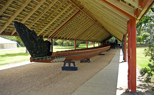
The historical importance of Paihia is remarkable. One of the most
important sites to visit is the Waitangi Treaty Grounds which overlooks the Bay
of Islands. At this location, the Treaty of Waitangi was first signed between
Maori and the British Crown on February 6, 1840; this date is now celebrated
lavishly as a national holiday for all New Zealanders to enjoy. Also, cricket was
first invented here and is practiced across the region with great pride. Watching
games of cricket would be a lovely event for one to attend while visiting the
region. Another building of interest in the Maritime building which is located
along the northern coast. This is a beautiful location to shop or enjoy the breezy
shoreline.
All across Paihia is a variety of shops, cultural centers, and restaurants.
These locations embody the culture and regional tastes experienced by the bay.
For example, Hansen's café is a quaint coffee shop that overlooks the heavenly
bay. New Zealanders enjoys coffee and pridefully offer it across the area. The
Bistro 40 Restaurant is also a good example of the cuisine that characterizes the
town. With a fancy for seafood, specializing in a fish of the day, this restaurant
artfully exemplifies the desire for fresh ocean caught fish that makes the
experience worthwhile.
The following link provide some images of the region:
1. Seafood Café - http://static.panoramio.com/photos/original/5493049.jpg
2. The jetty- http://static.panoramio.com/photos/original/17693296.jpg
3.Town center- http://www.panoramio.com/photo/10180709
Taupo
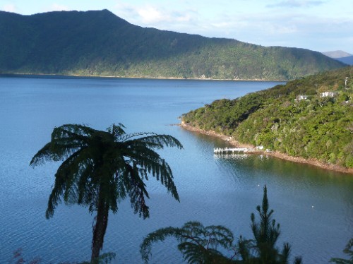
The second region of research is called Taupo, which is located in the
center of the north island of New Zealand. This location was built on the shores
of Lake Taupo which serves as one of the main tourist attractions in New
Zealand, providing the ability to boat, fish, and enjoy the nature of the
subtropical region. This town is more of a quaint getaway compared to the first
town which information was gathered for. This town has a rather suburban
aspect with the beautiful countryside providing golf courses and nature trails.
The Huka Falls Resort exemplifies the spacious countryside. The Huka Falls are a
set of waterfalls on the Waikato River that drain into Lake Taupo and are
beautiful to see.
Taupo bolsters several religious locations of interest including St. Patrick's
Catholic Church and Bahai'I Faith. These places reflect the Christian influence of
the crown on the country and are beautifully architectural wonders to admire.
As well, the everyday aspects of the town are something unique to be enjoyed,
including the food markets which provide an energetic look into the daily lives
of the townspeople. Even a fun entertainment park for children and adults alike
is located here called Taupo Adventure Park where one can get lost in mazes or
try his or her hand at a game of mini golf.
The following links are images of Taupo:
1. Beautiful waterfront- http://www.panoramio.com/photo/10900431
2. Internet Café- http://www.panoramio.com/photo/10688986
3. Lake Taupo Marina- http://www.panoramio.com/photo/16014298

blog Kristen Beebe

Dear Art,
Here is my blog entry for Paihia and Taupo!
Sincerely,
Kristen Beebe

updated attractions

Trevor Anderson

Motuti Marae:
The Motuti Marae is located off the Hokianga Harbour in North Land, New Zealand. A marae is a sacred place that serves both religious and social purposes. The Catholic faith is still a large part of the culture and traditions of Maori in Hokianga, and the Motuti Marae experience is based on the "whanu" or family, which is the heart of Mouti and New Zealand Maori culture. Visitors are welcomed to become part of the whanu and learn traditional weaving, poi-making, "waiata" (songs), "haka" (traditional dance), "kemu" (stick games) and bone and wood carving. Carving is an important cultural tradition for Maori, as the carvings represent different ancestors and relate the history and stories of the Hokianga Harbour.
Known to by the Maori as Te Kohanga, the Hokianga Harbour is a long estuarine drowned valley located on the west coast in the northwest of the North Land. It extends 70 kilometers inland from the Tasman Sea, and has a low population, meaning there are plenty of open beaches. The climate is generally mild throughout the entire year, allowing gardens to grow well in this area, and the estuary consists of a tidal river system lined with mangroves, small harbourside towns and family farms.
Whakatane:
In the Eastern Bay of Plenty in the North Island of New Zealand, right next to the Pacific Ocean, sits the town of Whakatane. One of the sunniest towns in New Zealand, its warm waters are world-famous for deep sea fishing and marine sports, and more yellow-fin tuna are caught here than anywhere else in the country. Here, one can relax on the sands of Ohope Beach, take a White Island live volcano tour, go whale watching and dolphin swimming, walk or run the Nga Tapuwae O Toi bush track, and watch rare sea birds at Ohiwa Harbour. Other Whakatane attractions include the museum, an observatory and Maori historical sites. There is plenty to do at Whakatane.
Whakatane is the gateway to White Island, which is one of the world's few accessible live volcanoes. Located 48 kilometers off the coast of Whakatane makes White Island easily accessible by boat or helicopter, and one could even take a scenic flight around the island. The acid lake in the island's depths offers an unforgettable insight into nature's primal creativity. White Island is also a great scuba diving destination as it provides a unique dive experience where one can explore the underwater steam vents or commune with large schools of fish.

http://www.motuti.co.nz/
http://www.motuti.co.nz/?q=gallery
Addison Reid
The first inhabitants of what is now known as Christchurch, New Zealand were moa-hunting tribes whom eventually hunted these flightless birds to extinction. These inhabitants were followed by the Waitaha tribe. Control of the Waitaha tribe and the Ngati Mamoe tribe was taken by the Ngai Tahu tribe until the settling of the European people. The first European settlers landed in Canterbury in 1815. By 1850 Europeans were operating whaling ships out of the Lyttelton Harbor, at about the same time a group of European settlers founded the city of Christchurch after arriving in Lyttelton Harbor. Christchurch became a city on July 31, 1856 by Royal Charter. Christchurch is officially the oldest established city in New Zealand.
The geology of the Canterbury region of New Zealand, where the city of Christchurch is located, is very unique. The Southern Alps are seen clearly from anywhere in Christchurch. These mountains are composed of greywacke and were formed 230 to 170 million years ago. Present day mountains in this area began forming 26 million years ago and continue today. The Banks Peninsula is an important part of the geology of the Canterbury region. Over millions of years, two volcanoes have linked due to eruptions of basalt. In recent geological history, alluvial fans have linked this volcano to the Southern Island. Also, due to movement of faults in the Canterbury region, there has been a history of earthquakes. It is suspected that the movement of these faults will cause earthquake damage in the future.
In 2001, Christchurch had a population of 334,107 people. This is the most populated district of the Canterbury region. Although the region of Canterbury has the most people of European descent of the country, most of the Maori people of this area are centered on the city of Christchurch. The city of Christchurch is known as Garden city for all the amazing gardens throughout this area. Some of the many gardens include Mona Vale, Botanic Gardens and the Ilam Homestead. The people of Christchurch enjoy the mountains, beaches, lakes and parks that are all within close vicinity.

http://www.christchurch.org.nz/About/
http://eeg.geoscienceworld.org/cgi/content/abstract/1/4/427
http://www.TeAra.govt.nz/en/canterbury-region/2

White Island is located in the Taupo Volcanic Zone in the North Island of New Zealand. It is the largest volcanic structure in country with 70 percent of the volcano under the sea. The steam from the eruptions of this volcano can be seen 10km into the sky on a clear day. The upper slopes of this island were previously mined for sulfur in the early 1900's. In 1914 mining stopped after the collapse of a crater wall that killed 12 miners. The sulfur was used for fertilizers, the export of sulfur ore and the manufacturing of sulfuric acid. The Maori name for the island translates to "The Dramatic Volcano" and "that which can be made visible." In 1952, White Island became a private scenic reserve and until 1995 the public had free access to the island. The island is now under permit controlled access.
White Island has no vegetation and instead as you travel around the island you see that the ground is covered by sulfur crystals. In the waters surrounding the island there is marine life such as dolphins, and many bird species. There are large colonies of Gannets that nest on the island and you can see them clearly as you approach the island.

http://www.gns.cri.nz/what/earthact/volcanoes/nzvolcanoes/newwhitei.html
http://www.tourism.net.nz/nz-places/white-island-new-zealand.html
http://www.wi.co.nz/
Rachel Schnaitman

Havelock

Havelock is a coastal village in the Marlborough region of New Zealand. It sits at the head of Pelorus Sound, one of the Marlborough Sounds.

State Highway 6 from Nelson to Blenheim passes through the town. Queen Charlotte Drive, which provides a shorter but very tortuous road to Picton proceeds east along the edge of the Sounds. Looking at the street view on google earth I saw many winding roads, similar to Queen Charlotte drive, that pass by mountains and lush green vegetation.

Some interesting facts about the town are that Havelock is the centre for much of the New Zealand green-lipped mussel industry and Havelock means "sea-war." Similarly, Havelock was named after Sir Henry Havelock, known from the Siege of Lucknow during the Indian Rebellion of 1857.

http://www.jefferswood.co.nz/images/photos/overlooking-havelock-and-marlborough-sounds.jpg

The Bay of Islands

http://darch.lenuh.si/Datoteke/Slike/Najlepse%20plaze%20sveta/Bay%20of%20Islands,%20New%20Zealand.jpg

The Bay of Islands is an area in the Northland Region of the North Island of New Zealand. It is known for its fishing and sailing and its gorgeous scenery.

The bay itself is an irregular 16 km-wide inlet in the north-eastern coast of the island. A natural harbour, it has several arms which extend into the land, notably Waikare Inlet in the south and Kerikeri and Te Puna (Mangonui) inlets in the north-west. The Bay of Islands formed when the sea drowned a number of river valleys, creating an irregular and attractive coastline of more than 800 km. The area shows signs of volcanic activity, with many eruption outlets and lava flows. Its outer limits are marked by the headlands of Tokerau on the north and Rākaumangamanga on the south
The first European to visit the area was Captain Cook, who named the region in 1769. Interestingly, The Bay of Islands was the first area in New Zealand to be settled by Europeans. Whalers arrived towards the end of the 18th century, while the first missionaries settled in 1814.

The bay has many interesting historic towns including Paihia, Russell, Waitangi and Kerikeri. Russell, formerly known as Kororareka, was the first permanent European settlement in New Zealand, and dates from the early 1800s. Kerikeri contains many historic sites from the earliest European colonial settlement in the country. These include the Mission House, also called Kemp House, which is the oldest wooden structure still standing in New Zealand. The Stone Store, a former storehouse, is the oldest stone building in New Zealand, construction having begun on 19 April 1832.
While exploring google earth I found lots of really great pictures and I found several youtube videos. My favorite was a video that details some scenery and lots of marine mammals. http://www.youtube.com/watch?v=Rf0fTdYw7rU&feature=player_embedded

Blog Entry

Brittany Schieler-
Locations: Mount Maunganui and Kaikoura

Mount Maunganui


Mount Maunganui is a town located on a peninsula in the Bay of Plenty, a popular coastal resort area. The town is overlooked by an extinct volcano of the same name (officially known by its Maori name, Mauao, and colloquially referred to as 'The Mount'). The town itself is situated on top of a sand bar that connects the volcano to the mainland (this structure type is known as a tombolo.)

According to Maori legend, Mauao was a once a nameless slave of a mountain called Otanewainuku. Mauao was in love with another hill, but was despaired to learn she had fallen for her captor. Deeply saddened, Mauao called upon the fairy people (Patupaiarehe) to help him drown into the sea. In the process, however, the fairy people were caught by the rising sun and forced to disappear. Therefore, the Maori name Mauao means 'caught by the dawn'.

Today, Mauao, 232 m high, attracts many to complete a thirty-minute hike to the summit. The 360 degree view on top is accompanied by possible sightings of several species of whales, dolphins, and sea lions. Surfing, volleyball, and diving are important recreations in this region. Mount Maunganui was once the site of a Maoria settlement (a pa) and its remains can still be seen. Mount Maunganui is also home to New Zealand's first artificial reef.


Kaikoura

Kaikoura is a town on the Kaikoura Peninsula on the east coast of New Zealand's southern island. The Kaikoura region is known for its unique combination of majestic, snowy mountain range (part of the Southern Alps) and its coast rich in marine life. The town itself is situated on a flat coastal plain that lies in between the Pacific Ocean and the mountains.

In Maori legend, Kaikoura is where Maui placed his foot when pulling up New Zealand's northern island from the sea. The name 'Kaikoura,' meaning meal of crayfish, comes from Tamaki-te-rangi, when he named it that after stopping there to eat when chasing his runaway wives. Crayfish remains an important part of the region's industry.

At several points along the coast, the mountain ranges drop right into the sea, a feature that has several implications for the aquatic environment found there. Because the Kaikoura Peninsula is an area of coastal upwelling, it boasts a great diversity of aquatic life. Of particular interest are several species that are brought up from the deep Hikurangi Trench as well as marine mammals such as Sperm Whales, Dusky Dolphins, and Southern Fur Seals. In addition, Kaikoura is one of the best places to observe sea birds such as albatrosses. Because of this, early European settlers used Kaikoura as a whaling station. Today, ecotourism is a major part of the region's economy.

Hamilton and Taupo

Alison Gutsche
(sorry this took so long! If you'd rather the word document, I attached that as well.

Hamilton:
Hamilton is a city located on the North Island of New Zealand and is part of the Waikato region. The University of Waikato is located in Hamilton and the city is known for its student population and its affect on the city. Hamilton is also home to the Waikato Museum (http://www.waikatomuseum.co.nz/page/pageid/2145842684/Home), which is known for its science exhibits and its exhibits on Maori culture. A major tourist attraction is the Hamilton Gardens (http://www.hamiltongardens.co.nz/). It has numerous different collections, which are then split into different garden types. Also slightly outside of the city is the Hamilton Zoo. Hamilton is also home to the Waikato Stadium, where many rugby matches are played. It is not home to the most famous rugby team of New Zealand, the All Blacks, though. Seddon Park (http://hamilton.co.nz/images/701.jpg), also located in Hamilton, is the main arena for many cricket matches. Hamilton is one of the largest urban areas in New Zealand and has a plethora of different places to visit within the city.

Taupo:
Taupo is a town located in the center of the Northern Island and is in the southern part of the Waikato region. The town lies on New Zealand's largest lake, Lake Taupo (http://feodyssey.com/wp-content/uploads/2009/03/lake-taupo-28761-lge.jpg). The lake was formed after a very large volcanic explosion thousands of years ago. The volcano has not erupted in a very long time and is considered dormant. The Huka Falls also are formed from the draining of Lake Taupo into the Waikato River. From the town, you can also see the Tongariro National Park across the lake. The town is well known for skydiving, bungee jumping, and different water sports. Many different interesting sporting events take place in Taupo including Ironman New Zealand (http://www.ironman.co.nz/) and the Lake Taupo Cycle Challenge, which involves a bicycle race around the entire lake.

Tuesday, October 13, 2009

NZ Locations

Katherine Fochesto

1. Christchurch, New Zealand is located in the Canterbury region of New Zealand. Christchurch was founded by English colonists and was originally named Christ Church, after a college at Oxford University in England. It is has been abbreviated Christchurch since the 1880s and is now the largest city on the South Island of New Zealand and the second largest city in the entire country.
The city is filled with Gothic-style architecture and graystone buildings. Christchurch has been nicknamed "the Garden City" because of the many parks and gardens, such as Hagley Park and the Botanical Gardens, that can be found throughout the city as well as the Avon River, which runs through Christchurch.
Cathedral Square is at the center of the city and surrounds Christ Church, the Anglican cathedral. The area around the square, including the four major avenues of Christchurch, is known as the central business district. This area of the city is also the cultural center where many festivals and cultural arts events take place. The Arts Center, former home of the University of Canterbury, now has many shops, studios and art galleries. The World Buskers Festival attracts thousands of people to the Arts Center every January. The World Buskers Festival is a festival in which 40 artists from around the world perform for the public.
An interesting area of Christchurch is Lyttleton. Lyttleton is located on a harbor and is connected to the center of Christchurch via tunnel. It was originally the port of call for Christchurch and was where the first British migrants landed. Lyttleton has a variety of shops, cafes and restaurants and a Farmer's Market on Saturday mornings.
http://www.christchurchnz.com/
http://www.christchurch.org.nz/
http://www.christchurch.nz.com/
http://www.christchurch.nz.com/lyttelton.aspx
http://www.christchurch.nz.com/arts-centre.aspx

2. Havelock, New Zealand is a small, coastal village on the South Island in the Marlborough region of NZ. It was named after Sir Henry Havelock during the Indian Rebellion of 1857.
The village is located near State Highway 6 between Nelson, NZ and Bleinhem, NZ. Havelock is often called "the Gateway to the Sounds" because it is located at the head of the Kenepuru and Pelorus Sounds and is close to the Queen Charlotte Sounds. Havelock is also called "The Green Mussel Capital of the World" because it is the world's leading supplier of Green Mussels.
The population of the village was estimated to be only 486 in the 2006 Census which makes it a great destination for those looking to get away from bigger cities. Many tourists visit Havelock for the Mussel Festival, usually held in March.
http://www.fourcorners.co.nz/new-zealand/havelock/
http://www.havelocknz.com/

Our Travel Destinations

Ethan Beswick
Bay of Islands & White Island


The Bay of Islands

On just our third day (let's hope for no jet-lag) we will be stopping at the Bay of Islands where we will take an afternoon cruise around the bay.  While there, we will be witness to the splendor that the great author Zane Grey described nearly a century ago (check this out), although, this inlet, located near the northern-most extent of the North Island, was first named by Captain Cook on his circumnavigation in 1769.  
We will hopefully be able to see some of the many exotic species that inhabit these parts including whales, dolphins, and marlin, amongst many others in our time to the bay.  But if birdwatching or big-game fishing don't seem like your ideal time then perhaps one of the one-hundred dive sites or boat rental or gourmet food sound a bit better.  For those of you who like golf, there is a local course that is said to have some of the most magnificent views anywhere.
The cliffs on the golf course to the jagged shores of the 150 odd islands present themselves quite stunningly in this 16 km wide natural harbor. The bay has a few notable arms in the mainland which were very important during the Cream Trip (yes, transporting cream between islands) and, even though it's not my topic, we must not forget that we will continue on to the jut of land at the eastern side of the island, Cape Brett.  Oh and did I forget to mention that a 2006 study found that The Bay of Islands had the second bluest sky in the world behind on Rio de Janeiro? Pretty sweet huh?


White Island

By the time we get to White Island, we should be pretty well settled in with the Kiwis, and if not, there is nothing like a morning boat ride to an active volcanic site to create a little more excitement.  The island, situated some 48 km off the north east coast of the North Island.  It is erupted from the sea and stands nearly 2000 m off the sea floor.  The island's monitored volcanic activity can be found at http://www.geonet.org.nz/ . Although there have been large eruptions in the past, most recently in the mid 80s, the volcano is normally at the lower end of an alert scale on eruptions.
White Island was named by Captain Cook and, like the Bay of Islands, is known for its big-game fishing.  There have been attempts at sulfur mining in the past, but the deaths related to them have forced their abandonment, so most of the island remains both tourist and geological attractions.
A small fun fact: a dino figurine was glued to a rock in front of the Geonet volcano camera on the island. Geonet decided not to have it removed, assuming it was a plastic toy and would not survive long in the corrosive environment, but as of the fall of last year, the figurine still remained.. maybe we will get to see it? who knows


Man I can't wait to get there...

NZW10 Study Abroad Two Sites Info - Emily Olson

Dr. Trembanis,

Attached is the info for my two sites from the study abroad homework. Only 80 more days until we leave, and I can't wait!!!!!!!

See you Thursday!
- Emily Olson

PS: I tried to find your AUV demonstration at Coast Day, but someone had told me it got cancelled?? Did I miss it? :(

Kaikoura and Taupo

Christine MacDonald
University of Delaware

Monday, October 12, 2009

Assignment #1

Rina Binder-Macleod

Assignment #1: Tongariro and Whitianga

Tongariro

We will be doing the Tongariro Alpine Crossing on January 28th, then staying the night in the Tongariro National Park. 

The Tongariro Alpine crossing is rumored to be the best one day hikes in New Zealand one of the top ten day treks in the entire world according to http://www.tongarirocrossing.org.nz/.  I guess we will have to see for ourselves!  But, from the looks of it, a trek that takes you across such a wide variety of landscapes and offers you magnificent views of mountains and the Emerald Lakes (named because of their color due to leached minerals) as well as paths along streams and on ancient lava paths sounds like it might as well be one of the best day hikes in the world!

To learn about the geological history of the region, I would recommend looking at these links:  http://www.teara.govt.nz/en/historic-volcanic-activity/3 and http://www.tongarirocrossing.org.nz/index.php?option=com_content&task=view&id=23&Itemid=38.  These sites explain the history of the eruptions in the area and explain that Mt. Tangariro is not a single volcano, but it is a series of craters.   There has been volcanic activity starting 300,000 years ago.  100,000 years ago was the beginning of the Ice Age, when these early eruptions were suspended.  Valleys were formed when the ice retreated.  Of particular note in the area is Mt Ngauruhoe, which is the youngest vent in the area with activity starting about 2500 years ago and last erupting about 35 years ago in 1975.

Last but not least, to please the eye, I recommend this website: http://www.panoramio.com/photo/650621.  If you click through the photos on the left, the image on the right shows you the corresponding point on a Google Earth Map.  This is an interesting way to compare the aerial view of the topography to an image taken from the ground.  It gives you a better sense of the varied geography of the region.  I think it is especially interesting to see the green turquoise lakes (filled in craters) in both images.


Whitianga

We will be staying 2 nights in Whitianga , starting on January 8th.    According to the Whitianga entry on Google Earth, this location is pronounced "Fitianga" and it is a small fishing town on Mercury Bay on the North Island of New Zealand.  The pictures on Google Earth show the shore in town to be lined with palm trees and the water is dotted with sail boats.   The tourism site, http://www.whitianga.co.nz/gallery.html, has some beautiful photos of the region.

Here is some history of Whitianga, according to this site: http://www.whitianga.co.nz/history.html, Whitianga has a history rooted with the sea and seamen.  In about 950 AD, the Tahitian explorer and sailor Kupe landed in Whitianga and called it, "TE WHITIANGA-a-KUPE - the crossing place of Kupe".  Later, in 1769 Captain John Cook landed in Whitianga.  He spent a little under 2 weeks taking astronomical data and observing Mercury and determining the location of the Bay (currently known as Mercury Bay).  Currently, this area is a fishing town as well as a tourist destination.

As for the geology of the region, the book "The Field Guide to New Zealand Geology: Rocks, Minerals, and Fossils" on Google Books: http://books.google.com/books?id=t-cOAAAAQAAJ&pg=PA151&lpg=PA151&dq=Whitianga+geology&source=bl&ots=-iYefY_Z35&sig=YAx6Of6PbLGveYAAOKu3PH1wjHU&hl=en&ei=IobTSuu-GYrflAeEoM2oCg&sa=X&oi=book_result&ct=result&resnum=8&ved=0CCYQ6AEwBw#v=onepage&q=&f=false offers an in-depth explanation of the geology of the region.  The rhyolite of the region ranges in age from 3 million to over 6 million years old.  The rhyolite in the region is "often flow banded (banded by layers in flowing lava) "(152).  Also prevalent in the region is andesite that has been altered due to hot water flowing through the cracks and pores and depositing dissolved minerals within the andesite. For more detailed information, I would recommend checking out the book link it has tons of diagrams and information.